 In the period from 1600 to the next century, households on Samos seem to combine viticulture with the cultivation of cereals, horticulture and various trees. During the following century (1700 to 1800) there are numerous testimonies, mainly from travelers, who record the most important productive activity of Samos, the cultivation of grapes. Muscat wine becomes a purely export item, since it was intended for sale to the French merchants of Smyrna.
According to historical sources, the capital of the island, Samos, owes its development to the economic and work activity that developed in the area of the natural port “Vatheos”, due to the trade and distribution of wine since the 17th century. The Ottoman state, after 1770, imposes (after the acre tax and the tithe), a new tax on wine. In the period 1800 – 1850, the increase in the cultivation of vines and other marketable crops continues. In 1832 the island of Samos was declared a “Hegemony” with a Greek Ruler, appointed by the High Gate.
The following period, 1850 – 1912, is eventful and its events will continue to influence viticulture in various ways. This period is defined by a ten-year severe crisis in the agricultural production of Samos, which began with the harsh winter of 1849 – 1850 that froze and destroyed vineyards and trees. It continued with the appearance (after a year) of the disease known as powdery mildew, which reached its peak in 1854. The crisis seems to have ended five years later, as sulfur had previously been applied (1856) to treat of the vine disease but also the protection of the vineyards.
In 1870, the phylloxera insect appeared in France and destroyed millions of hectares of French vineyards. This leads to an increase in demand for Samian wines, which see a significant increase in sales and prices in 1880, with record ferry connections to the island of Samos! France’s wine producers, because of the well-known phylloxera problem, turned to importing ever larger quantities of Samian wine. In 1883 out of a total production of 99,300 stators, 62,000 were exported to France.
In 1888, a new and even bigger crisis begins in the Samian wine sector. The crisis is due both to the prices of wine and raisins, which are collapsing in the international markets, but mainly to the rapid spread of phylloxera which leads to the destruction of the Samian vineyards. In 1900 the few remaining vineyards in Samos were placed under the care of the “Hegemony”.
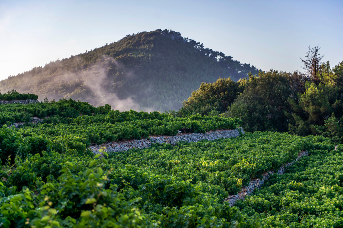
Gradually, after the disaster, the Samian vineyard was replanted using American subjects which were resistant to the disease. With these cuttings, all the muscats that had been saved were also grafted. In this vineyard, which continues to this day, the now grafted vines adapt again to the special and diverse soil and climate conditions of the island. This combination gives the special and versatile character of the “white microrogus muscat of Samos” that we know to this day.